Illinois Route 78 is one of the longest state roads in Illinois. The highway has an interesting early history, and a pre-history that is intact, but in parts. Here’s a big piece of that classic stretch from Hooppole to Annawan.
This is Part 2 of a 3-part series of a drive I took on March 21, 2023
| Part 1 | Part 2 | Part 3 |
| Pray the “Rollery” (LINKED HERE) | “Classic” Route 78: Hooppole to Annawan (you are here) | Henry-Bureau Moraine (LINKED HERE) |
ANNAWAN – Up until the late 1910s, there was no numbered highway system in Illinois. Most roads were unnamed, and any maps often just had lines, both straight and squiggly, on them.
Illinois began its numbered highway system in 1917 and expanded it in 1924. Route 78 was among the highways planned in the expansion. The highway would become one of the state’s longest, at just over 200 miles, and it was constructed in parts across its length.
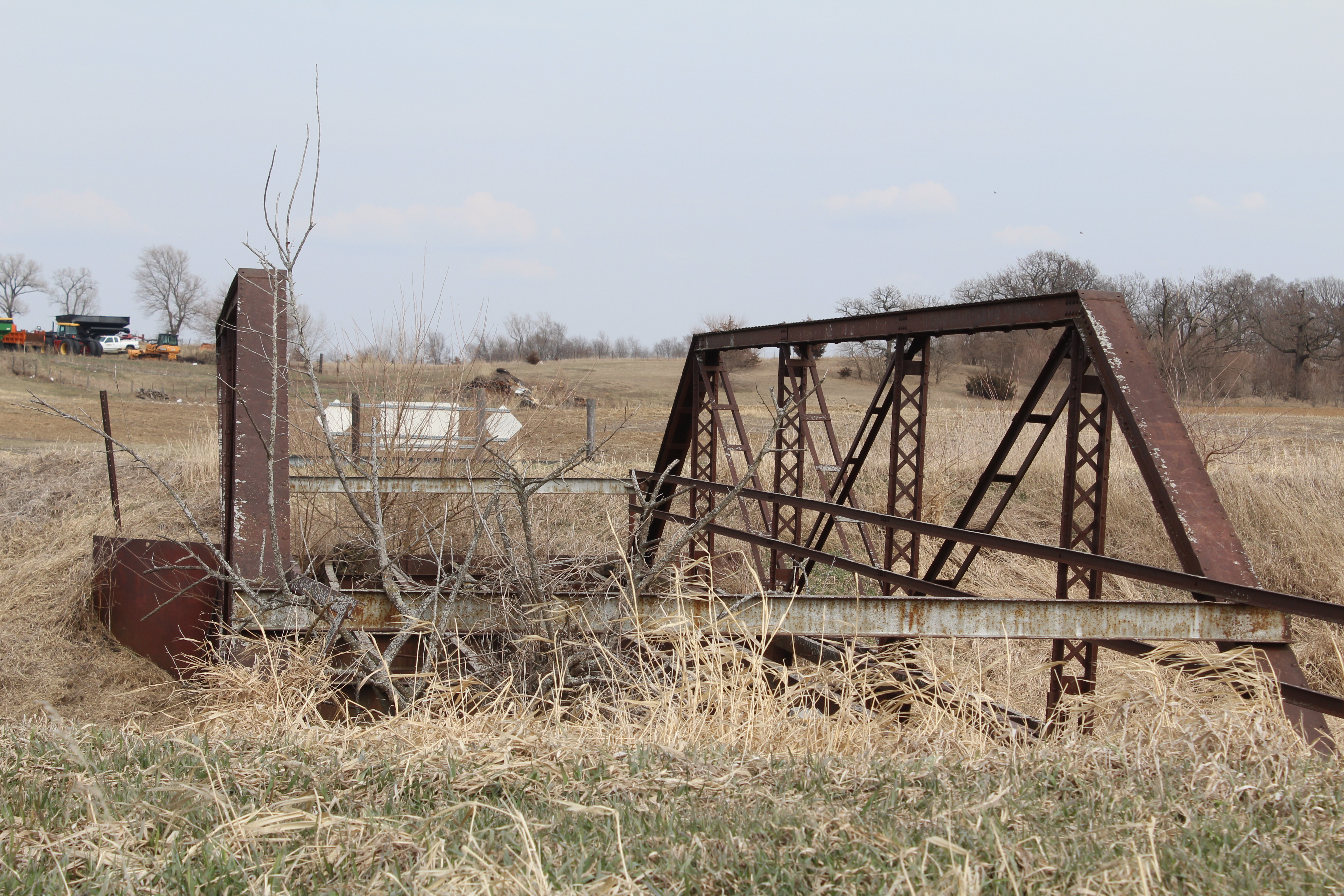
When 1930 rolled around, going from one section of completed portion of Route 78 to another meant having to travel on more narrower roads people would use to get from town to town. Before the “hard road” was paved between Hooppole and Annawan in the mid-1930s, those going from Hooppole to Annawan took a more meandering route through the country, about a mile west of the “new” road. Much of that path is still there, but a truss bridge across Mud Creek has long since been abandoned and neglected.
This bridge doesn’t get visited much, with yellow “dead end” signs posted before both approaches giving motorists no reason to drive on it, unless your the owners of houses and farms on each side of the bridge. To get a personal view of this abandoned beauty, turn west on Engles Road from Route 78 about 1.25 miles north of Annawan.
Mud Creek runs from the Green River north of Atkinson to a place hear the T-intersection of the Hennepin Canal and its Feeder. This is flat land, and was prone to flooding before levees were constructed on both ends of it around this bridge. That means one will have to ascend a levee to get a glimpse of it.
The bridge doesn’t look like much now, but at one time it was the main link between Hooppole (and points north) and Annawan (and points south). The road itself was never officially signed as Route 78, like the other stretches between completed sections.
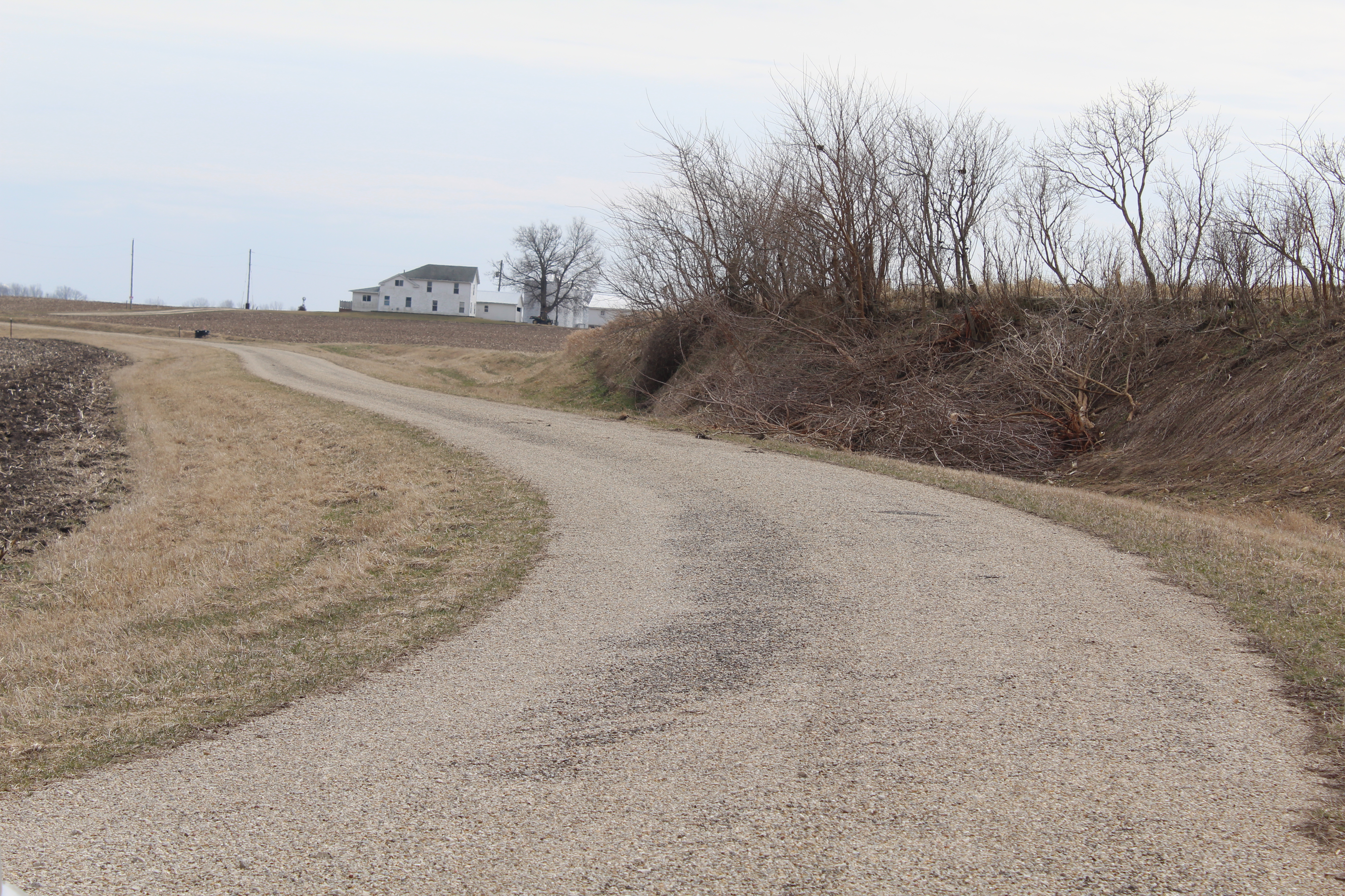
This portion of the Hooppole-to-Annawan road begins going west on County Road 2400N off of the current Route 78. About one-half mile down is a triangle intersection with Wilsey Road (Henry County only has real road names for some of their roads), where you’ll curve to the left. Wilsey Road meanders for about 8 miles, and along the way crosses the Green River on a modern bridge. At the stop sign with County Route 22 (a road going west to Atkinson), the first “dead end” will force you to turn east back onto Route 78. Engels Road is another half-mile south, and at that intersection, the old road continued south down the current highway, past the old brick Baker School, and into Annawan.
One of the signs a road was well-traveled is the existence of a cemetery. The Maple Grove Cemetery is along Wilsey Road, but you won’t see a sign noting it; rather you’ll see “Alba Township Hall & Cemetery.” This cemetery has two sections: one with more recent stones in the back across a field, and another close to the township garage parking lot with small stones dating back to the Civil War era. There’s a trio of real small stones that look like there’s nothing legible on them anymore. One can assume these stones haven’t had flowers near them for many decades.
Sometimes it’s fun to see things off of the beaten path. Route 78 has plenty of these parallel drives. It’s my hope to make this entry the first part of a series of “Classic Route 78.” There’s a stretch closer to my home in Sterling that I’ll save for another date; this one goes from Lyndon to Hooppole.
To visit:
Abandoned Mud Creek Bridge
Google Maps link
Wilsey Road drive points:
Southern end: Google Maps link
Northern end: Google Maps link
About state Route 78: The highway runs for about 210 miles from the Illinois-Wisconsin border north of Warren in Jo Daviess County to just north of Jacksonville. It is the fourth-longest state highway in Illinois: No. 1 is the all-concurrent Route 110 (the Chicago to Kansas City Highway), No. 2 is the long-running state Route 1 on Illinois’ east end, and No. 3 is state Route 9 going east-west.
Route 78 also extends into Wisconsin as that state’s own highway, going for another 110 miles up to the I-90/94/39 intersection in Portage, Wisconsin.
The highway in Illinois goes through four county seats, skirts by another seat, and goes through two other cities with a population of around 12,000. The county seats are Mt. Carroll (Carroll), Morrison (Whiteside), Havana (Mason) and Virginia (Cass). Jacksonville, home to Illinois College and the state schools of the blind and deaf, is the other seat. The highway also goes through Kewanee and Canton. Bypassed sections are plenty south of Canton, and several parallel segments of its pre-history continue to exist in towns such as Morrison, Lyndon, Leon Corners, Liverpool, and Arcadia.
If this article made you learn something new, give it a “like” at the bottom at the bottom of this page.

This was very interesting. Would like to know where 1st Amish church was 2 miles N of Annawan.
LikeLike