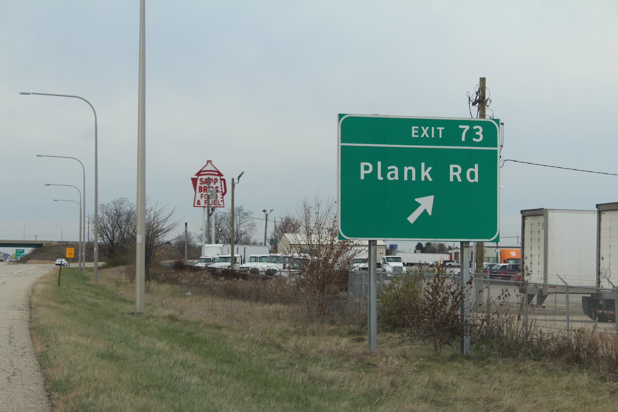
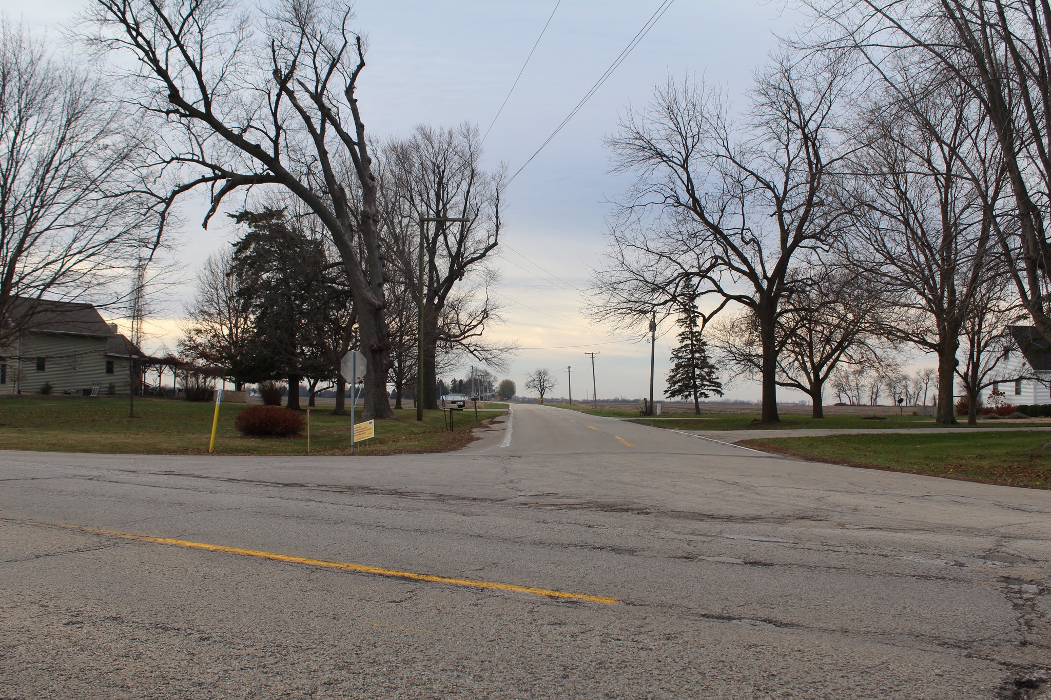
One of Interstate 80’s exits in the La Salle-Peru area is Plank Road. No, it’s currently not a road made out of planks, but at one time it used to be, and it served as a stagecoach trail going northwest of Peru.
Plank Road is perhaps best known for local travelers as the exit with Sapp Bros. Travel Center and its notable red and white neon coffee pot sign … or it’s also known as a major player in Peru’s “gas wars” of cheap, competitive fuel prices.
The road itself has a story to tell, too. It was a major navigational route for early settlers, largely from the 1820s to the 1840s, who came to northwest Illinois from the Illinois River. Weaving around hills, swamps and other natural obstacles was common in early stagecoach days, but the construction of more navigable paths made it more convenient for travelers. It was like a luxury, and because of that, this particular trail was a tolled road: Tolls were collected from travelers at certain stops.
As far as the planks go, they were laid out from a trail’s point of origin out to as far as it could get. Traveling on evenly-surfaced planks was much better than traveling through mud, dirt, divots and clumps.
Infrastructure and transportation improvements ultimately led to the demise of many stagecoach trails, and some exist in their entirety or in fragments. Their purpose has long-lasting effects: Settlements were made through traveling on the road, and so were businesses – both during stagecoach days and much well after cars and trucks were dominant.
In this article, we’ll look at Plank Road and take gander at what all is in or around it for its duration. At the end, we’ll find out where it eventually went.
Photos from this trip can be viewed on Facebook at the following link:
https://www.facebook.com/media/set?vanity=cody.cutter.14&set=a.10236752155449842
(Note: You have to be on Facebook to view them. I am working on a system to make more pictures public. Stay tuned!)
In Peru
La Salle-Peru served as the western terminus of the Illinois and Michigan Canal, an idea that started in 1816 and not fully realized until its completion in 1848 due to governmental and financial setbacks. With the two cities determined to be a terminus of the canal, it attracted plenty of people and business from the east who came from the paralleling Illinois River. Even in the first 20 years after Illinois became a state, in 1818, northwest Illinois was still sparsely settled with several Native Americans still calling it their home. One town in the area became larger than the rest, and those in Peru sought to connect to it with the building of the Plank Road trail in early 1830s.
When the Plank Road trail was completed, those who arrived in Peru by boat landed at its original downtown area at Water Street. This area of town ceased to be a downtown business district in the coming decades due to flooding, and the downtown relocated above the bluff. Some businesses, including some bars, continue to thrive in the riverfront area, as well as one of the La Salle-Peru area’s oldest businesses, Maze Lumber, which opened in 1848.
Putnam Street connects old and new downtowns with the ascent up the bluff. An intersection with Main Street used to exist in the middle of the incline, but it has since been removed. A truss bridge once connected Peru with areas across the Illinois River at the intersection of Water and Putnam, but it was removed sometime in the late 1950s (on the other side lies the private Peru Sportsman Park, with some right-of-way evident and another truss bridge over a nearby pond).
A one-block jog to Peoria Avenue within the “new” downtown takes travelers north out of Peru. Peoria Avenue used to be part of U.S. Route 51 from the 1920s to the late 1950s (when a bypass was built). Plank Road exits at the edge of town going in a slight northwest direction, where it takes its usual name; this used to be a “Y” intersection for many years before the installation of a roundabout about a decade ago.
Plank Road goes out of town by going through the community airport, the aforementioned Sapp Bros., and an industrial park. About 3 miles later, going into Bureau County, the road hits its first town, which is unfortunately best known for a major mining disaster in 1909.
Cherry and its coal mine
One big thing in Cherry is hard to miss: The large mound on the north side of town. This used to be the Cherry Coal Mine, which was owned by the Chicago, Milwaukee and St. Paul Railroad (the “Milwaukee Road”) to supply its fleet of engines with coal. This Milwaukee Road line used to run from Beloit south to Ladd, and then back north to Cherry; most of the line – south of Steward – existed from 1874 to 1981 (in its later years, it was owned by the Chicago, Burlington and Quincy, and later, Burlington Northern; the line is still extant from Flagg Center to Beloit).
Cherry’s coal mine brought many people to town, but disaster happened on Nov. 13, 1909: a fire killed 259 men and boys and eventually became the third-deadliest in American history. Such a disaster of that magnitude brought forth situations of aftermath that aren’t seen today, including the burial of many workers in a cemetery not far from the mine. The Cherry Miner’s Cemetery includes the final resting places of several workers; some stones are written in miners’ native German, and others sit so close to each other that it’s easy to surmise that those were of children. Other mine memorials and markers can be found throughout town, as well as a museum at the village library.
An old fire escape chute can be found on the south end of the former Cherry School, which ceased to be a school a few years ago. The fire chutes are like the tubed slides one sees today on park playgrounds or at water parks.
Plank Road goes along Cherry’s eastern edge. The road today T’s with Illinois Route 89, turn right onto the highway and the road eventually continues on its northwesterly direction.
Arlington and LaMoille
The Plank Road trail’s remaining stretch within Bureau County takes it through the villages of Arlington and LaMoille. There’s not much in Arlington, other than the trail’s crossing with the CB&Q’s (and BN’s and now BNSF’s) line connecting Chicago and California.
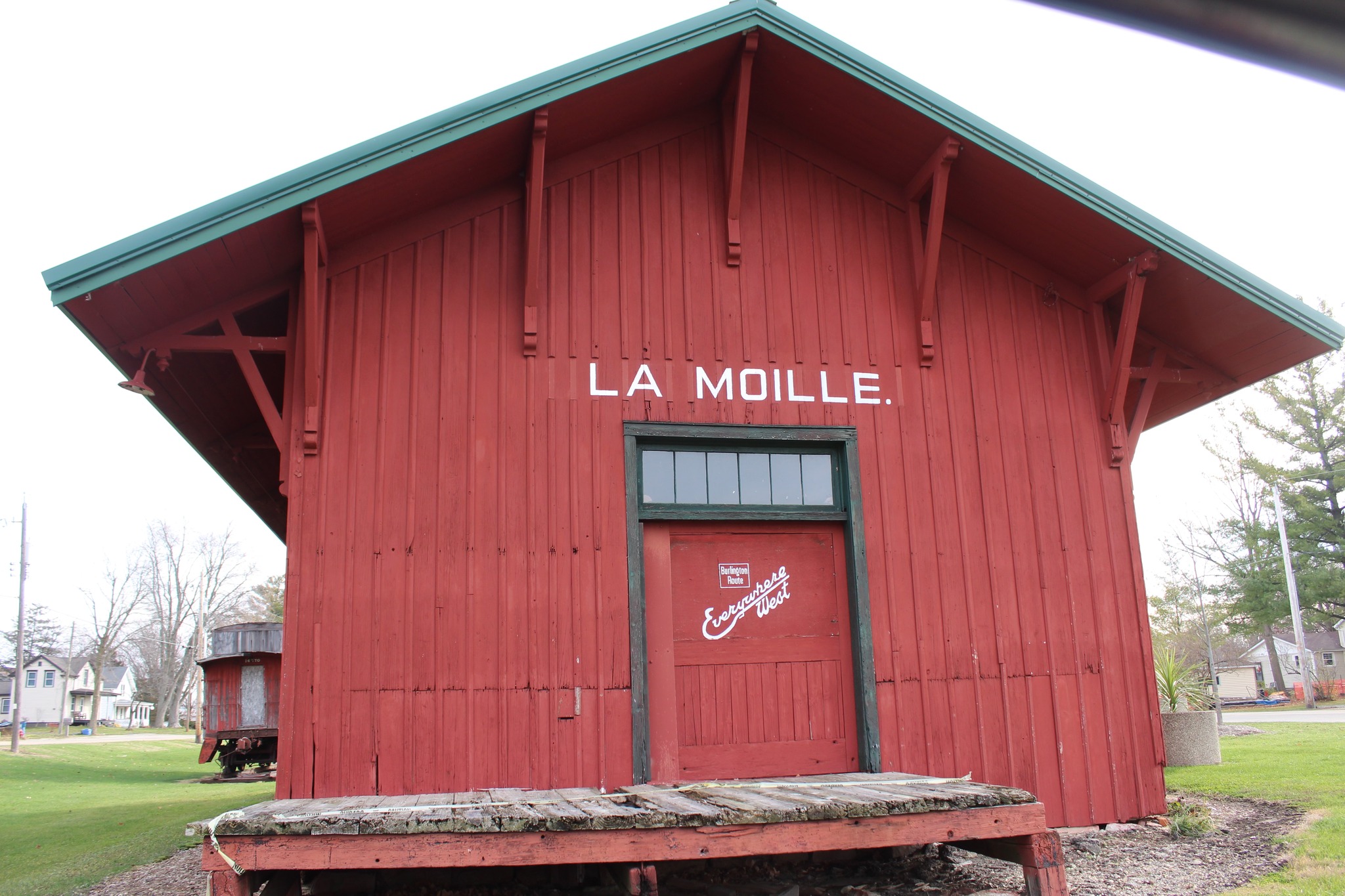
LaMoille also has a crossing with another CB&Q line, but it’s a smaller east-west branch. The town’s vintage 1871 depot has been restored, and an old red CB&Q caboose sits next to it – although it looks a little weathered. LaMoille is best known for its annual Buffalo Days festival in early June, and that event is best known for its buffalo burgers.
Route 89 ends at the south edge of the village, terminating at U.S. Route 34. The Plank Road trail continues eastbound on the federal route to the town’s north edge, where it intersects with the terminus of Illinois Route 92. The trail continues northbound onto a county road a few miles out of town. U.S. 34 also is part of an old stagecoach trail as well, one that connected Paw Paw with Galesburg.
Going north out of LaMoille, a couple of stately Italianate brick houses stand out along the road. They have been restored from their original states and give the old trail a sense of elegance. The road crossed into Lee County, where it is known as LaMoille Road.
A split in the road
The Plank Road trail takes one of two different directions within most of Lee County. This is because of a rivalry between the villages of Binghampton and Shelburn (originally known as Rocky Ford) over establishments of post offices. The Binghampton route takes travelers of today through the east edge of Woodhaven Lakes, jogging slightly on U.S. Route 52 to Searles Road into Binghampton, and then into Amboy. Dixon historian Tom Wadsworth explains more about the situation in his publication, “Dixon: The Great Stagecoach Transfer Station,” linked HERE.
For this article, I’ll focus on the Shelburn alignment.
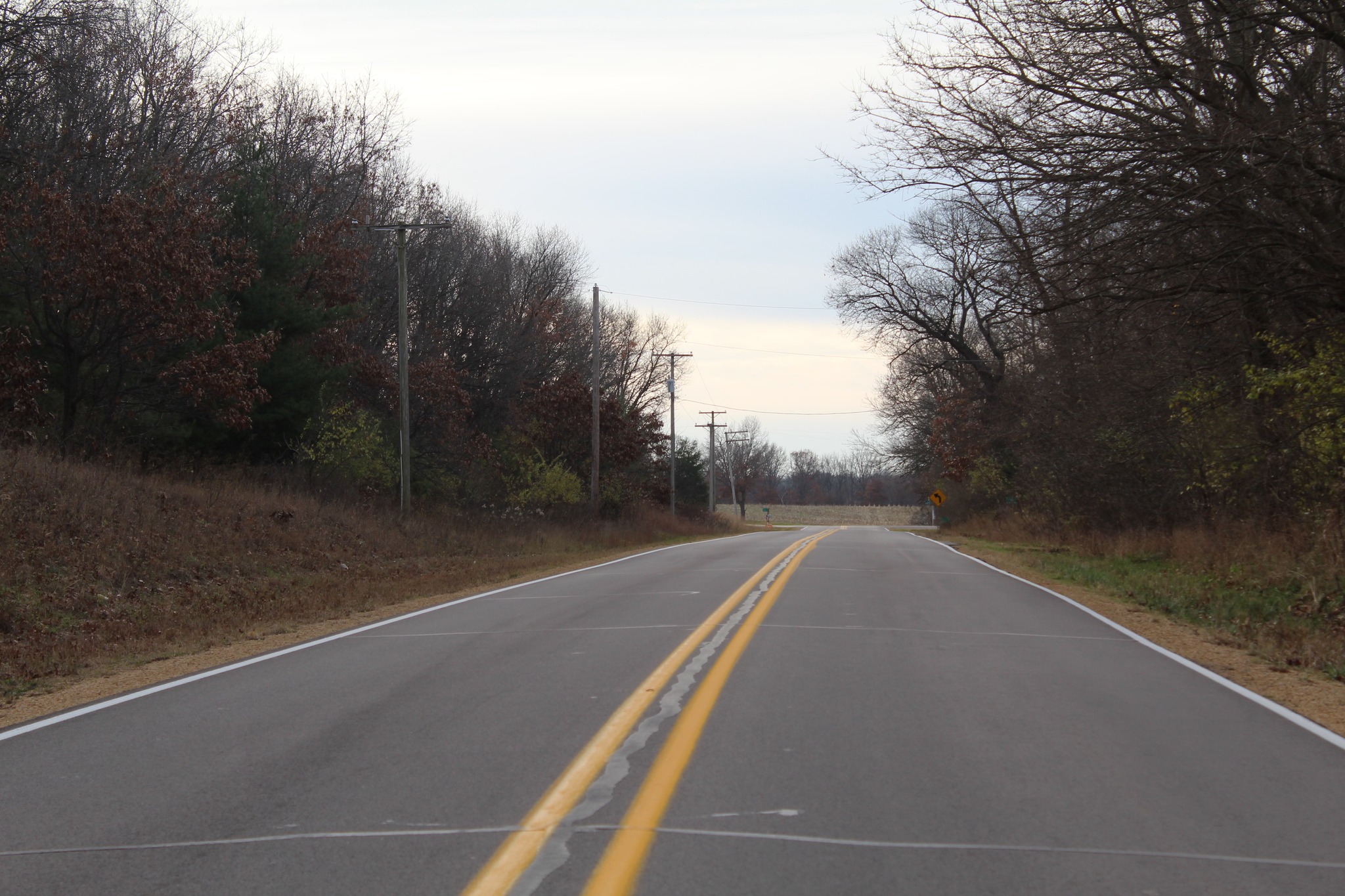
The Plank Road trail is no longer extant at several points in Lee County. One mile north of the county line, today’s travelers can turn left (west) on St. Mary’s Road for 1 mile and then right (north) on Rocky Ford Road where St. Mary’s Mission Cemetery is. While on Rocky Ford Road, the road starts to go in a northwesterly direction and back to its original trail alignment.
The trail winds its way near Palestine Grove, which is just a grove of trees today but is locally-historically known as the potential site of a Mormon temple. The area became a popular place for Mormons who didn’t want to travel west from Nauvoo when they did. A small cemetery is the only extant reminder of the Mormons’ interest in the area, as well as a road named Morman (sic) Road.
After Palestine Grove, the trail enters what used to be Shelburn. Only a farm house, a cross road and a bridge over the Green River remain of what was a community. The road today enters Amboy, but the old trail veered off onto what is the dead-end Newman Road. For the next few miles north of Newman Road, the trail is no longer extant. Today, this area is known as the Green River Industrial Park.
You know what will fix this trail? Duct tape.
Not really, but the origins of duct tape happened not far from where the Plank Road trail used to traverse, some 110 years after original construction.
The Green River Industrial Park originally opened as the Green River Ordnance Plant in 1942; there were 420 structures of various kinds constructed at the 8,000-acre arsenal in just eight months. The plant made artillery for World War II. Only a handful of old buildings remain, as well as bunkers where they once were stored. The plant closed in 1946 with the war over.
It was at GROP where worker Vesta Stoudt of Prophetstown came up with a solution for soldiers to open boxes faster. She wrote a letter of recommendation to President Franklin Roosevelt, who sent the idea to the War Production Board for its development.
Eldena Road
The trail, meanwhile, picks up at the northwest corner of the former plant ground, just south of the intersection of Red Brick Road and U.S. Route 30. The trail, which continues northwesterly, takes a slight jog: west on South Eldena Road, and north on Eldena Road. The tiny village of Eldena is nearby.
Just north of the intersection of the two Eldena roads is an old, abandoned brick building that looks something like an old high school building. I used to think it was a school for many years, until finding out that it was the old Lee County Poor Farm. Poor farms were places where people who couldn’t afford to live on their own, such as the elderly and sick, could reside. This one lasted into the years of World War II, and despite not being used in that capacity in 80 years, it continues to stand as private property – so don’t go exploring.
Eldena Road continues up to a T-intersection with U.S. Route 52. This is the actual end of this trail. Route 52 is part of a trail that connected Chicago with Dixon – the intended destination of the Plank Road trail.
Looking at a Lee County map, one may wonder why Eldena Road goes in a diagonal direction. In this case, as well as with most other diagonal roads, they once were Native American or stagecoach trails. If one draws a longer diagonal line across the map and overlapping Eldena Road, you get an idea of what the trail used to look like, and find out that sections of Red Brick and Rocky Ford roads align with it.
Dixon, founded as Ogee’s Ferry in 1828, was at one time the most established town in northwest Illinois in the years around the Black Hawk War of 1832. According to the aforementioned publication by Wadsworth, it was the hub of many trails around the area. The Plank Road trail was its connection to La Salle-Peru and the Illinois River.
Wrapping up
The newest curiosity for me now turns to whether the founder of my hometown of Sterling, a man named Hezekiah Brink, went on this road from Indiana. Local histories tell that Brink came to Sterling from Dixon. Brink came to Illinois from his former home of Ripley, Indiana – about 20 miles southeast of Valparaiso. Halfway between Ripley and Valparaiso, as the crow flies, is the Kankakee River. The Kankakee River flows into the Illinois River near Channahon. Perhaps Brink came along that path? We don’t know for sure.
Plank Road, as it’s known in the La Salle-Peru area, has some history to it. It’s important enough to have an exit from the interstate. Perhaps now travelers know a little more of it than just being that Sapp Bros. exit.
Photos from this trip can be viewed on Facebook at the following link:
https://www.facebook.com/media/set?vanity=cody.cutter.14&set=a.10236752155449842
(Note: You have to be on Facebook to view them. I am working on a system to make more pictures public. Stay tuned!)
