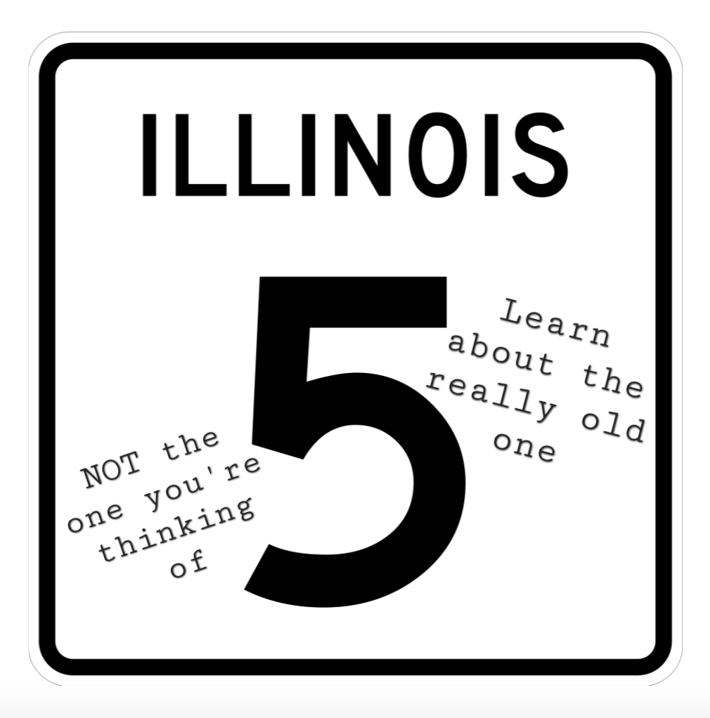
Illinois state Route 5 used to be what’s now U.S. Route 20 until 1925.
Currently, Route 5 only goes a small stretch throughout the Illinois Quad Cities, from Interstate 80 to the south side of Rock Island at U.S. 67 (11th Street).
Route 5 used to go from the Quad Cities to the “Hillside Strangler” intersection with Interstates 290/294 west of Chicago, on what is now Interstate 88. There also was a stretch that connected Rockford and Belvidere before the coming of Business U.S. 20.
This post isn’t about the multi-lane freeway, or John Deere Road.
This is about the REALLY OLD Route 5, which went from Chicago to East Dubuque.
Actually, this post is about the stretch of the REALLY OLD Route 5 from Elizabeth to East Dubuque.
When the state of Illinois came up with a highway system in the late 1910s, it was meant to connect major cities. Getting from Chicago to Dubuque was kind of an easy, straightforward drive until going past Stockton. Then when it hit Elizabeth, it got much more winding. The winding-ness of the highway was so much that, in the late 1920s, a new path of U.S. Route 20 was laid out going west of Elizabeth – which is the current alignment going to, through and past Galena, and toward Dubuque.
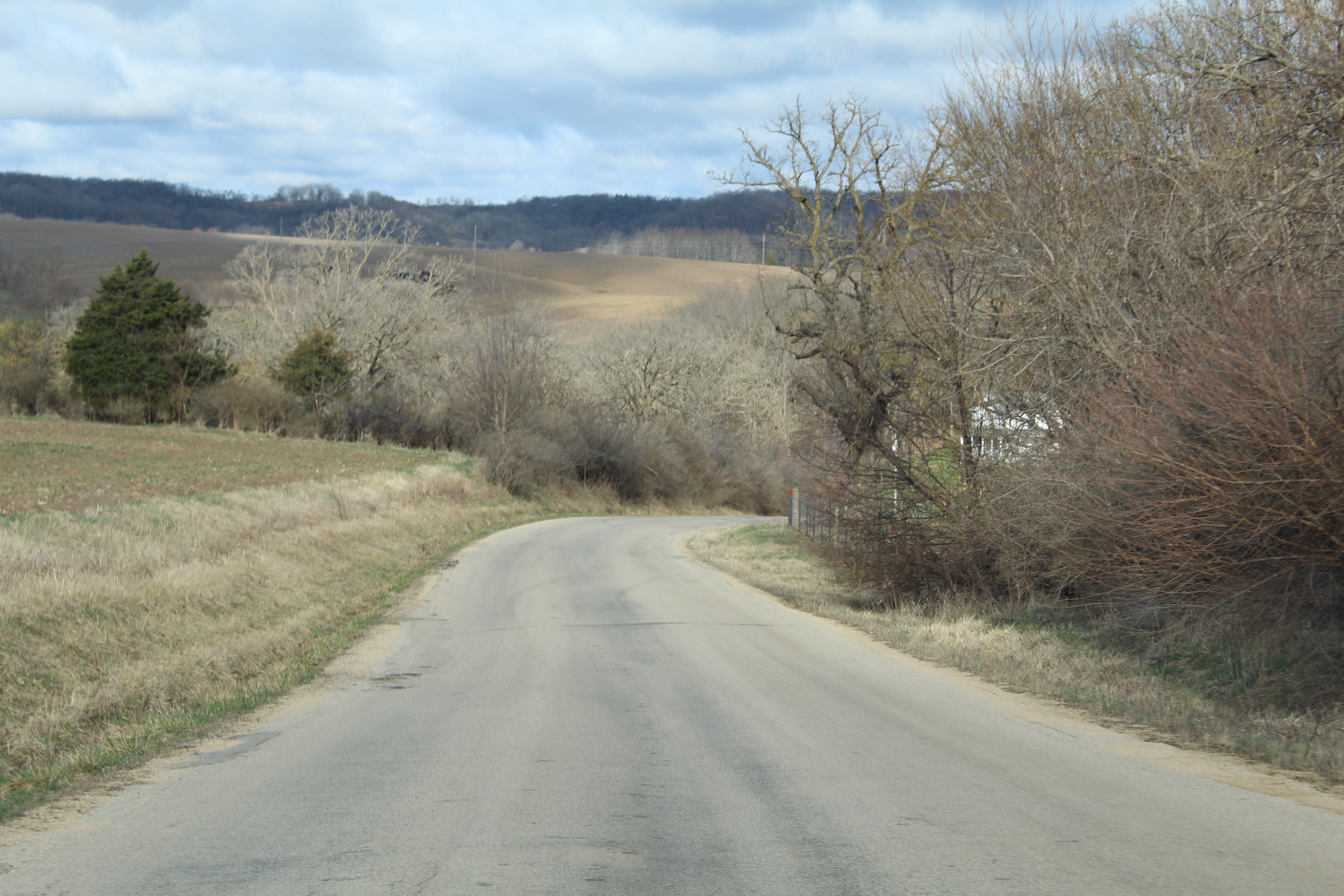
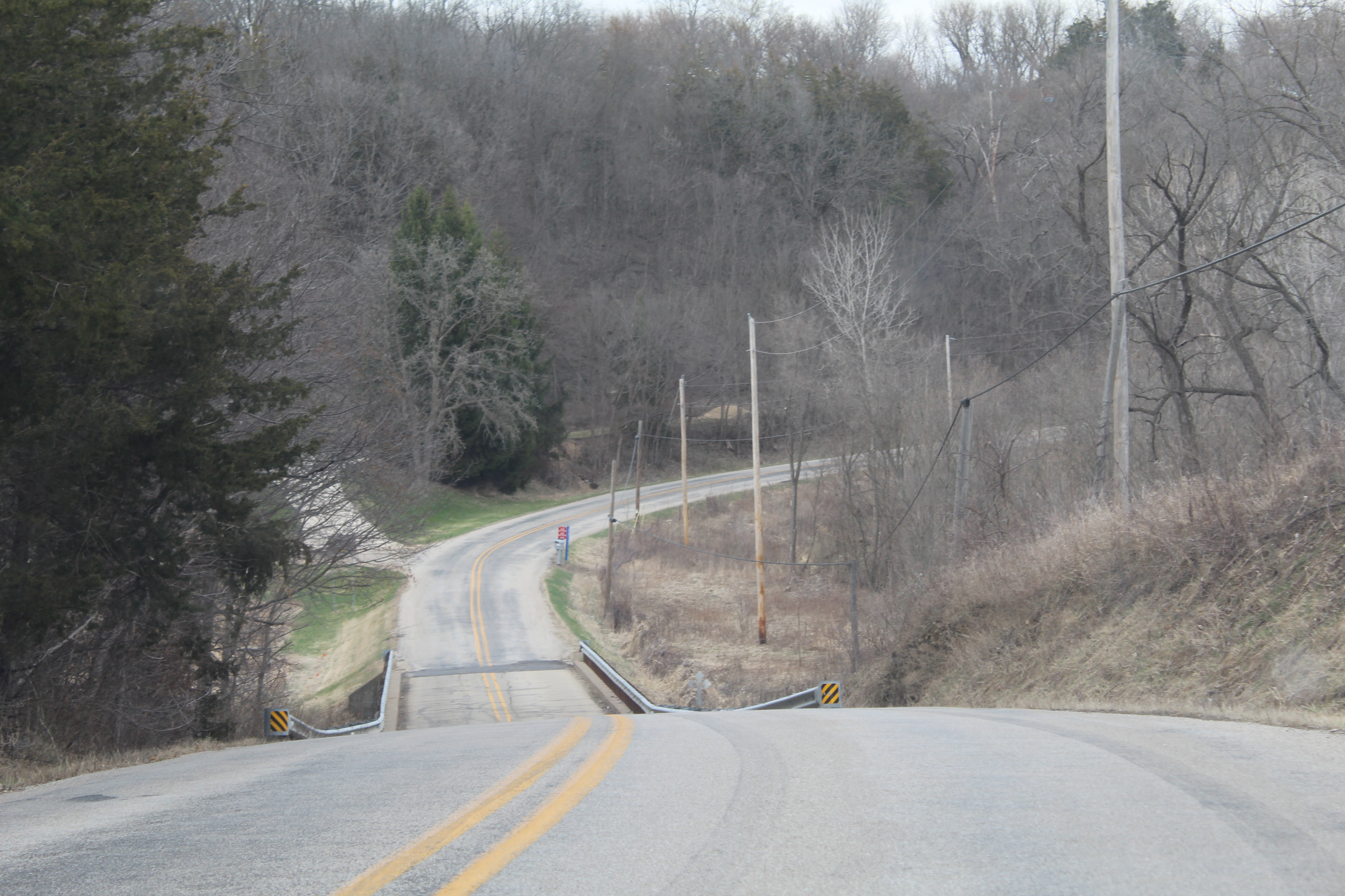
The Really Old Route 5 – which will be referred to henceforth as ” Classic Route 5″ – carved its way through the hills of Jo Daviess County carefully, going through areas that farmers used a lot – and still use – and along creeks at the bottom of ridges for a stretch. It’s a neat route to go on if you have time to spare, or are looking for a motorcycle scenic route to Dubuque (which is very scenic itself).
The Classic Route 5 stretch, going west from Elizabeth has two main stretches: One to the Galena Territory homeowner’s association community, and the other west of Galena. There also is a short segment that was broken off in a 2010 flood of the Apple River, which will be explained shortly.
To get to the starting point on this road trip, take U.S. Route 20 WEST to Elizabeth from Woodbine, or from Derinda Road (part of the Elizabeth Blacktop from Mt. Carroll).
****View my Flickr photo album of this adventure by clicking here****
Elizabeth, turning 200 years old this year
Elizabeth‘s history starts in 1825 with the Apple River Fort, which became part of Black Hawk War activity 7 years later. The Apple River Fort Park has a replica of the fort and informational signs of life and times in the area when the fort was around. Historical presentations take place at the fort on occasion, and an information center is near the park to learn more about it. Getting to the fort itself involves a short drive along an old right-of-way that used to be part of the Chicago Great Western railroad.
The Chicago Great Western linked Chicago to Oelwein, Iowa and other points past that from 1887 until the 1960s. Its history is preserved in the old town depot, which is open during the summer months. A video journey of places along the path of the CGW is linked here.
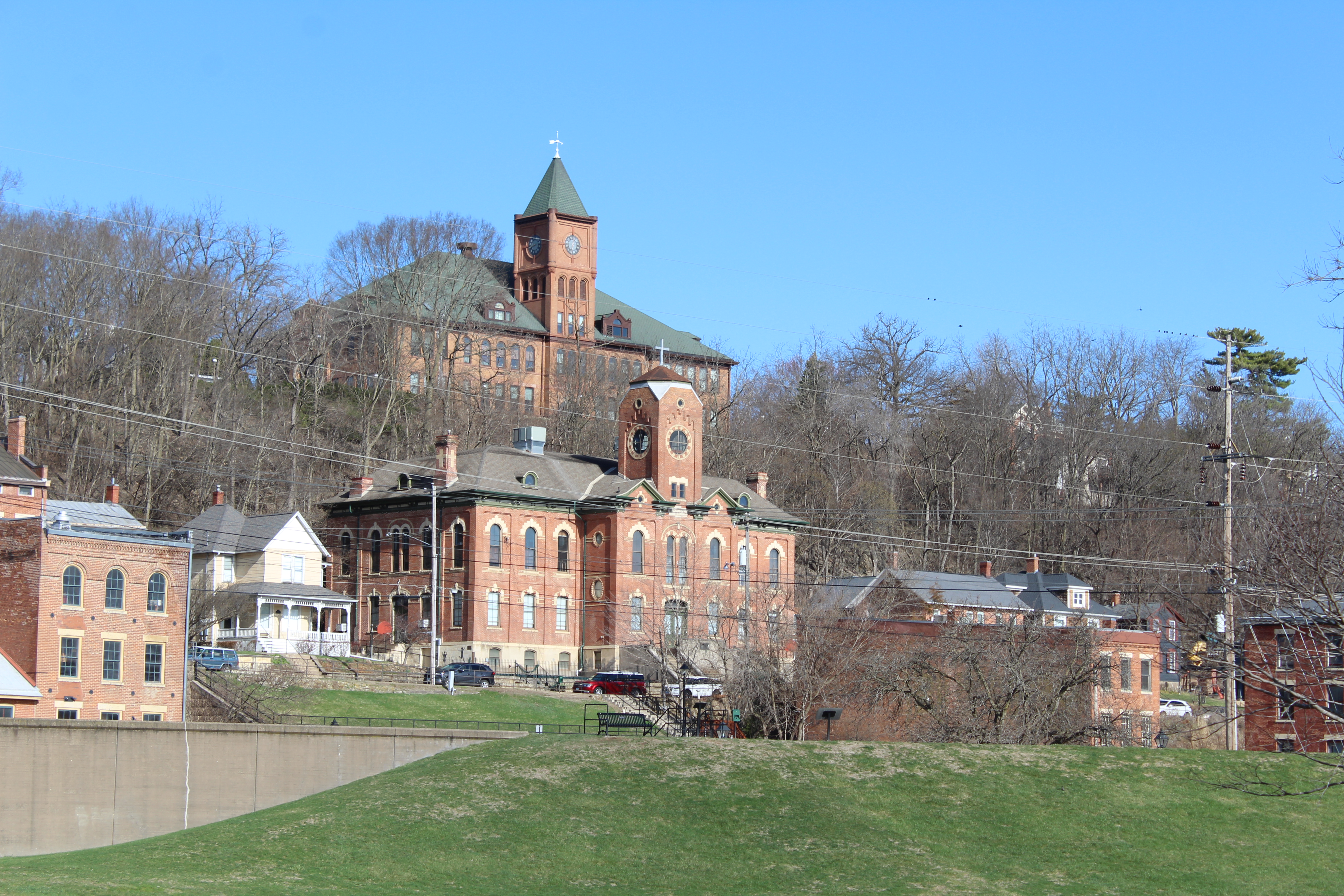
Elizabeth also is home to a few places to eat, plus Paul’s Vintage Bikes Museum (housed in a former Opera House), Elizabeth’s Grand Antique Co. (housed in a former school building, which once was its high school), and a few miles to the north Dittmar Farms and Orchard. Links to Sauk Valley Media’s “Lake Lifestyle” stories on the three are provided.
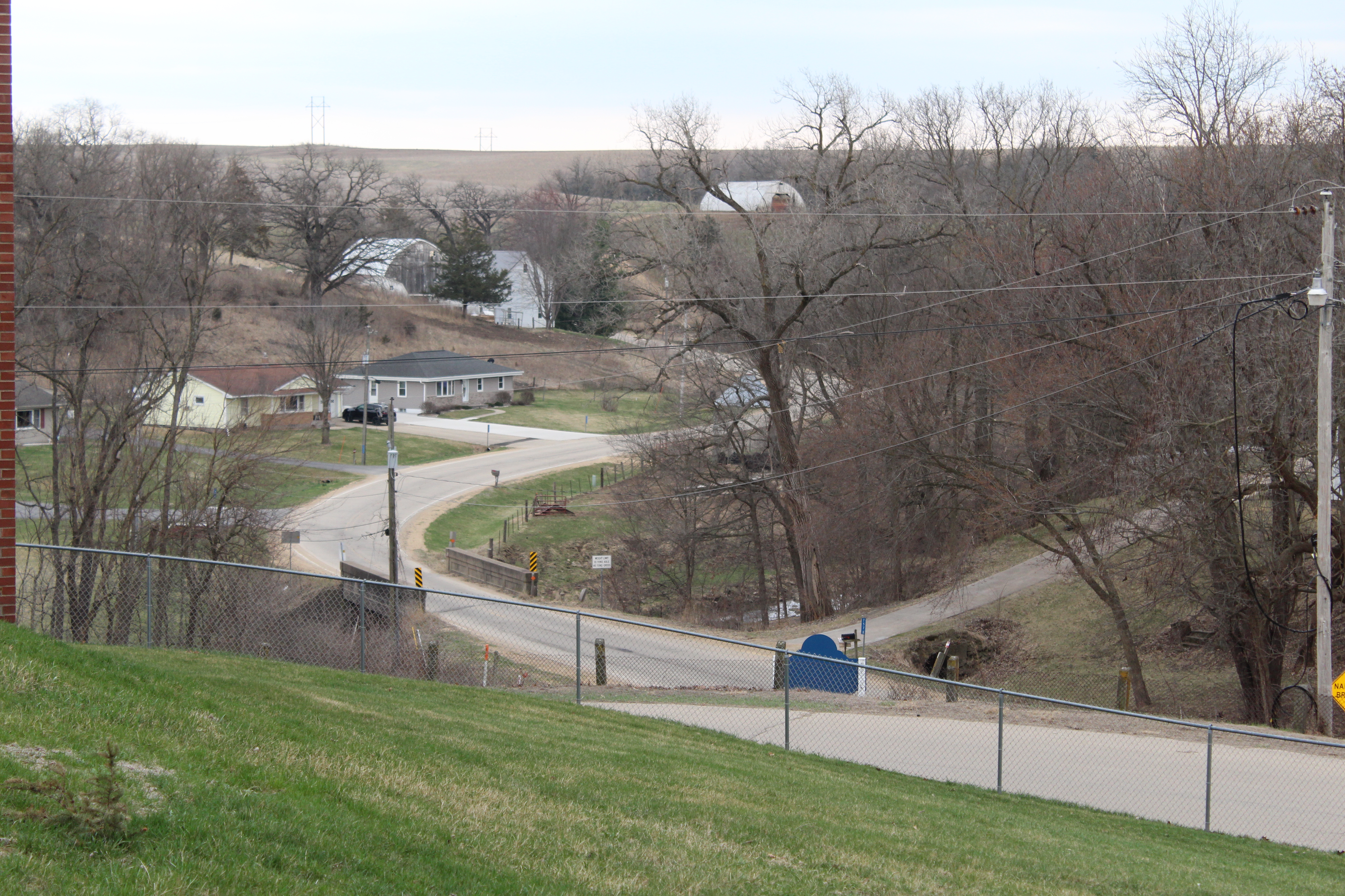
Classic Route 5 ran through the middle of downtown Elizabeth, and curved to the left going north. Currently, U.S. Route 20 then curves to the left again going out of town – however, at this point, we’re going to go straight onto what looks like a town side street (Main Street), which leads Classic Route 5 toward the old Georgetown Road Bridge, which, sadly, is no longer.
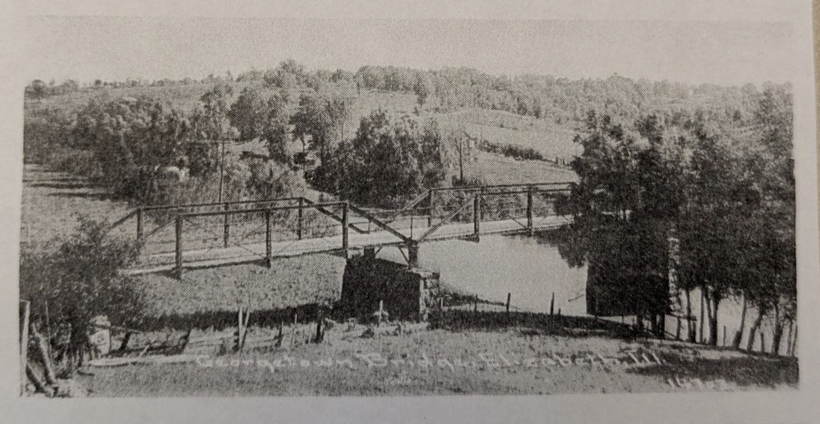
There once was a bridge
Leaving Elizabeth going west on Main Street (which looks like a country road at this point – if you’re on the highway, you missed your turn), you wind down a small hill by a solar panel property. An old, white “welcome” sign still stands. This road leads to Schap Park, named for the late Illinois State Police trooper Gary Schap, of Elizabeth. Schap served on the Illinois State Police force for 36 years, and later was a police officer in Elizabeth. The park, which is along the Apple River, contains a ball diamond and a swing set, and there may be more there soon.
Just across the Apple River from the park is a dead-end barricade and a limestone bridge abutment. There used to be a one-lane truss bridge over the river at this point. After the highway was realigned, this was a simple country road until a flood of the Apple River washed it away in 2010. The park, and it being in honor of Mr. Schap, turned the site from a down note into one that honors his memory and provides a place for play.
Since there is no bridge anymore, to get back to the Classic Route 5, backtrack to U.S. 20 and take it out of town; when you get to Elizabeth-Scales Mound Road, turn right. Follow for 1.5 miles to the intersection with Georgetown Road (this one is diagonal and may be tough to find), and turn left.
Zip lines, rock formations, and, obviously, Galena
Georgetown Road turns into Longhollow Road shortly after leaving Elizabeth-Scales Mound Road. This segment of Classic Route 5 has plenty of hills and curves, and largely sits at the bottom of a ridge with a creek running parallel to it. There are also bluff-like rock formations within sight, and even some rocks stick out from the ground on occasion. And lots of farms, too.
While you’re traveling when the weather’s nice, stop for a zipline adventure! Longhollow Road also is where Long Hollow Canopy Tours is located. This place offers zipline tours and other outdoor park adventures along the familiar Jo Daviess County scenery. Find it on Facebook or go here for more information.
Longhollow Road continues west, meandering along until reaching the entrance to the Galena Territory, a large HOA community that also is home to a large golf course and Eagle Ridge Resort and Spa. At the T, intersection, turn left for a small section, and then right on U.S. 20. Follow to Galena, where there’s plenty to see and visit. I will have a post about Galena in the near future.
Once your stay in Galena concludes, continue north on U.S. 20, and take the right where state Route 84 splits off toward Hazel Green, Wisconsin. After the split-off, follow for about 1,000 feet and take the first left (High Ridge Road).
Winding around Menominee
Classic Route 5 continues toward the town of Menominee at this point. About 2.5 miles in, there is a tri-point “fork in the road” intersection in front of a large brick farm house, just past the crossing of the Sinsinawa River. You’ll want to take the road at the far left, which is Valley Road, and go past the farm buildings and cattle. Follow for two miles, and turn right at the T (this is a realigned intersection).
Menominee is a small town off of the beaten path, but is home to the large and imposing Nativity Blessed Virgin Mary Catholic Church. There is a subdivision of houses 1.5 miles southwest of town called Steeple View. Menominee once had a tavern, J.M.’s Tap, that was around for many years until the owners retired in 2023.
Leaving Menominee, follow the road for a little more than a mile until you reach a large dairy farm on the left side of the road. This is Berning Acres Farm, which offers farm tours and activities for the public, on top of being an active dairy farm. Find it on Facebook or go here to learn more about it. The next turn is on a road called … wait for it … “Highway 5.” The road from there remains the only current reminder of the fact that there was once a Highway 5 in the far northwest corner of Illinois.
The road known as “Highway 5” ends at the far north edge of East Dubuque. The views on this road include the stately Sinsinawa Mound just across the state line in Wisconsin and another scenic ridge bottom. There is one T intersection on this path, where you’ll want to turn left. This road also dips into Wisconsin for a small section, which is truly unique among Illinois state highways past or present.
Once in East Dubuque at the T intersection, turn left. This is Illinois Route 35, which is the shortest numbered state highway. It, like Illinois Route 136 through Fulton, is so named because of the number in the other state.
End of the road in East Dubuque
Illinois Route 35 (and Classic Route 5) meanders down hills and into downtown East Dubuque, where the bars don’t close until 3:30 a.m.
Turn right at the stop sign intersection in downtown East Dubuque to go through the business district. Among the taverns is Mulgrew’s, known for its chili dogs. They serve them until it’s 3:30 closure, so if you’re driving through East Dubuque at 2:45 a.m. and are hungry, have a chili dog there. Mulgrew’s was established in 1921, and mementoes of its history is along the walls. A liquor store with the same name is next door.
The sight of the large Julien Dubuque Bridge looms over downtown East Dubuque. It was built in the early 1940s as U.S. Route 20 proved important to transportation during World War II. Classic Route 5, which ceased to be a couple of decades earlier, did not cross there. The downtown street ends in front of a rail yard. However, it once went through it and toward the current railroad bridge where the Canadian National cross the Mississippi River. Just before the CN crosses the river, it goes underneath the Dunleith Tunnell. There was a toll bridge for cars next to the CN bridge until the Julien Dubuque Bridge was built. In Dubuque, the highway continued next to the former Star Brewing Company building.
In conclusion, this is a nice scenic route that provides a glimpse of what the Driftless Area looks like, without having to cross into Wisconsin (except for that tiny bit).
This path is a winding one with plenty of turns, so be careful.

Great read about Old Route 5
LikeLike
Great reading and photos. I love reading about the past and times long gone. I often wonder if those that are gone would appreciate the changes that have occurred over time or hate it. My bet is that they’d rather see the places as they used to be!
Steve Ravanesi
LikeLike