Argyle’s abundant agriculture
The Paulsen Agricultural Museum of Argyle in Boone County, Illinois is the latest installment of Cody’s Road Trips’ Magazine Article series. These destinations are places that I have written about for the magazines that I write for with my work for Shaw Media. When I’m not embarking on road trips, I’ll post some of my older road trips for work to keep this website fresh. There will be more to come.
—
One of the magazines that I write for is the northern Illinois edition of Shaw Media’s “Ag Mag.” This is operated out of Shaw’s Sauk Valley office, where I work, and I write almost all of the stories in this publication. The biggest weakness to doing this is that I have no farm experience whatsoever, so agriculture isn’t really a strong suit. I do try to learn more about it with each issue I work on.
Sometimes I find myself falling back on my own strengths – such as tourism. I look at our magazine as something that can attract readers of all ages, and that includes educating the younger ag-minded people about how things were done many decades ago. Perhaps it would also educate me as I learn more about agriculture. This hatched the idea to feature the Paulsen Agricultural Museum of Argyle, a few miles east of Machesney Park in the Rockford area. Argyle is the small community that the museum – once a working farm – is located.
The museum, abbreviated as PAMA, advertises itself as “a non-profit organization dedicated to educating people about agriculture and its importance,” according to its Facebook page.
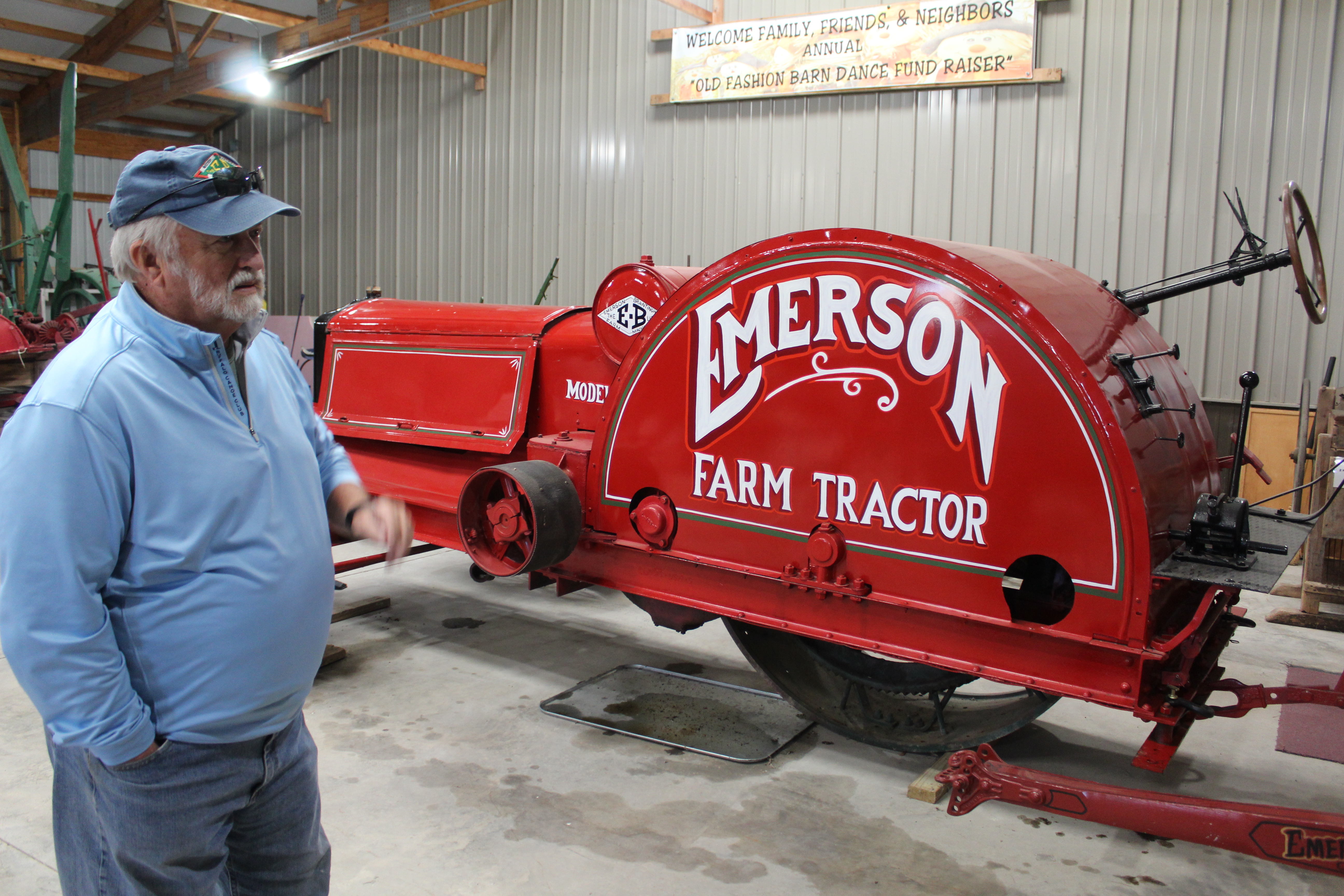
I took this trip on Oct. 10, 2023 for publication in the Fall 2023 “Ag Mag.” Billed as the largest of its kind in northern Illinois, Paulsen’s has everything from large collections of machines, tools, tractor seats, farm toys, and many other pieces of general local history – from sharing what rural life was like more than a century ago to the history of a railroad line from Rockford to Kenosha that once passed through Argyle.
You’ll also find a two-headed pig. The young pig is kept in a glass formaldehyde jar.
Several of its items come from the Rockford area, which includes Boone County and Belvidere. Boone County is unique among northern Illinois counties when it comes to agriculture because of several active Grange Halls within its borders – the most in Illinois, the last I checked. Granges were early farm-based social clubs.
I have posted the link to my article from the Fall 2023 “Ag Mag” below. Learn more about PAMA by reading the story, and hearing from the people who care for it.
Paulsen’s Agriculture Museum of Argyle
6950 Belvidere Road, Caledonia (Caledonia address, Argyle location)
815-885-3846
Hours: 10 a.m. to 3 p.m. second Saturday of the month from April to October, or by appointment (24-hour notice)
Admission: $10
Online: Facebook, paulsensagriculturemuseum.com
| Direct link to this magazine article | Link to the magazine this article was published in |
| Link to the index of this magazine | Link to past Cody’s Road Trips Magazine Series posts |
[Note: The ISSUU magazine link widget above is best compatible for desktop/laptop/iPad monitors; it may appear too small for reading on a standard cell phone. Cell phone users also can download the entire magazine to their phones to improve reading quality by clicking on the direct link to this magazine article (above) and tapping the “download” icon at the bottom bar. The ISSUU magazine page previews flip book shown on this page may not be visible on email subscription newsletters. Safari internet browser users might not see the complete article as displayed on the link’s pages; try opening it in another browser for a better reading experience.]
