Local history fascinates me, but certain topics of local alternate history fascinates me even more.
These are situations such as what would have happened if the railroad went through this town instead of the town next to it, or what if Northern Illinois University had decided on Polo for its location instead of DeKalb? Really, Polo was a candidate for the college’s home in the late 1800s.
Maps and old roads fascinate me as well. I’ve written about some of them, including the Indian Head Trail motor route from Galena to Peoria, and the Plank Road stagecoach trail going northwest from Peru. In this entry, I will focus on a small stretch of another early motor route, the Pontiac Trail, from Joliet to Dwight. We’re only focusing on this stretch because it’s forgotten when people think about traveling between Joliet and Dwight.
U.S. Route 66 connected Joliet and Dwight from 1926 to 1974, when it was removed in favor of the paralleling Interstate 55. Alignments during that 48-year span have changed, but it went in the general direction of going south of Joliet to the Wilmington/Coal City area, and then southwest toward Dwight.
The Pontiac Trail was what Route 66 was called before 1926. It was also called Illinois Route 4 as well. The Pontiac Trail, however, did not go through the Wilmington/Coal City area – it instead went west to Minooka and Morris, and then south to Dwight. Meaning, when Route 66 was planned, Minooka and Morris were bypassed. This was because the path through the Wilmington/Coal City area was more direct.
To think, if Route 66 was to be on the exact alignment of the Pontiac Trail, Morris could have been a town with a dozen or so Route 66 stops, and Minooka’s business district could have been a little south of what it currently is.
Route 66, and almost all over one- or two-digit U.S. federal highways in the nation, are observing 100 years in 2026. Much of the nostalgia over the centennial tends to focus on Route 66 – which once went from Chicago to Los Angeles, and went through large cities such as St. Louis and Oklahoma City. On a last note of providing context, the stretch between Chicago and St. Louis was perhaps the most traveled due to St. Louis being a Top 10 city in population up until World War II; so there’s going to be more to see along that path. More information on this will come in a future post on the Route 66 Museum in Pontiac.
[Cody’s note: In the middle of this entry being prepared, it was announced on March 25, 2026 that the official eastern “starting point” of U.S. Route 66 was being relocated to Navy Pier from the area around the Art Institute of Chicago. I will have my thoughts about this decision in a separate post in the near future. Meanwhile, back to the topic at hand …]
Let’s explore the forgotten stretch of the old Pontiac Trail, starting from Dwight and going toward Joliet … Click on this link and open in a new window for my trip’s photo album to follow along.
There are two stretches of Route 66 in Dwight: an older two-lane road on the west and north edges of town, and a “newer” four-lane road a little to the west of it (and Interstate 55 is a little to the west of that). On the two-lane stretch of Route 66, travelers will pass the Ambler’s Texaco Gas Station, which is now a Route 66 relic. Keep going through town (pass the Crazy ’80s Car Museum, a future stop for me), and reach a three-way intersection in a residential neighborhood with Morris Road. This is where the Pontiac Trail went north toward Morris. It jogs left-then-right immediately going out of town at the Livingston/Grundy county line, but leaving town it will look like your typical unstriped country road, now called Dwight Road. We’ll follow that north into Grundy County.
Today’s travelers get from Dwight to Morris on Illinois Route 47, which is one mile east of Morris Road.
After going over Interstate 55, proceed about 3/4-mile to a plain intersection with Scully Road. Turn left and you’ll go straight into Streator. This was the pre-Illinois 17 stretch that travelers took from Streator to Dwight before the days of the numbered highways. Let’s keep going north for a mile. You’ll pass the Dwight Airport and reach Stonewall Road. At this intersection, where the farm buildings are located, there is an old street name sign that is well oxidized, but legible. A newer set of signs is at this intersection, but it’s cool to see the old versions of them still sitting there, like they are still waiting to be moved and recycled.
Not much happens for another 7 miles going north. A crossing of the BNSF railroad is next to a cemetery with a road leading to the small town of Mazon (“muh-ZON”). That town was founded as a railroad crossing with the BNSF (then the Santa Fe) and the now-abandoned Kankakee and Seneca Railroad.
Another 7.5 miles and there still isn’t much to see other than driving on a country road. There is an old schoolhouse-turned-home at the intersection with Spring Road. So you’re getting to think there isn’t much to this stretch. Then you get closer to Morris. At the northeast corner of Dwight and DuPont roads is what looks to be a curved ghost alignment. When Illinois 47 was built in the late 1920s, the main path south of Morris was bypassed to this point.
Proceed two more miles north on Dwight Road to the intersection with Southmor Road, and you’ll see something special – an old, abandoned gas station. This was the Donohue Gas Station, its history documented further in this Grundy County Historical Society newsletter. It’s perhaps the only other building of note on the Dwight Road and Pontiac Trail stretch between Morris and Dwight.
Let’s go another mile north on Dwight Road. This is where the fun begins. Most traffic turns right onto Pine Bluff Road, but we’ll go straight into what looks like a private driveway (but it’s county “maintained”). It’s actually the original 1910s pavement with potholes galore, shrubs on the edges and a path into woods. Drive very slowly with this really, really, really rough road. An old “stop ahead” sign that looks like it’s been there 50 years warns motorists going the opposite direction. An original old concrete creek bridge remains. This path continues to a dead end at the Morris Boat Club, but some pavement remnants are still extant as they proceed further north to where a bridge used to be that crossed the Illinois River. When the current Route 47 alignment was complete in 1934, this former bridge was taken down.
To get into Morris, you have to backtrack to Pine Bluff Road and cross the river on Route 47. Turn left at Illinois Ave. and left again at Calhoun St. At this point is where the other side of that now-gone bridge is. The existing truss bridge at that sight is a former railroad bridge. This is the entry to William Stratton State Park.
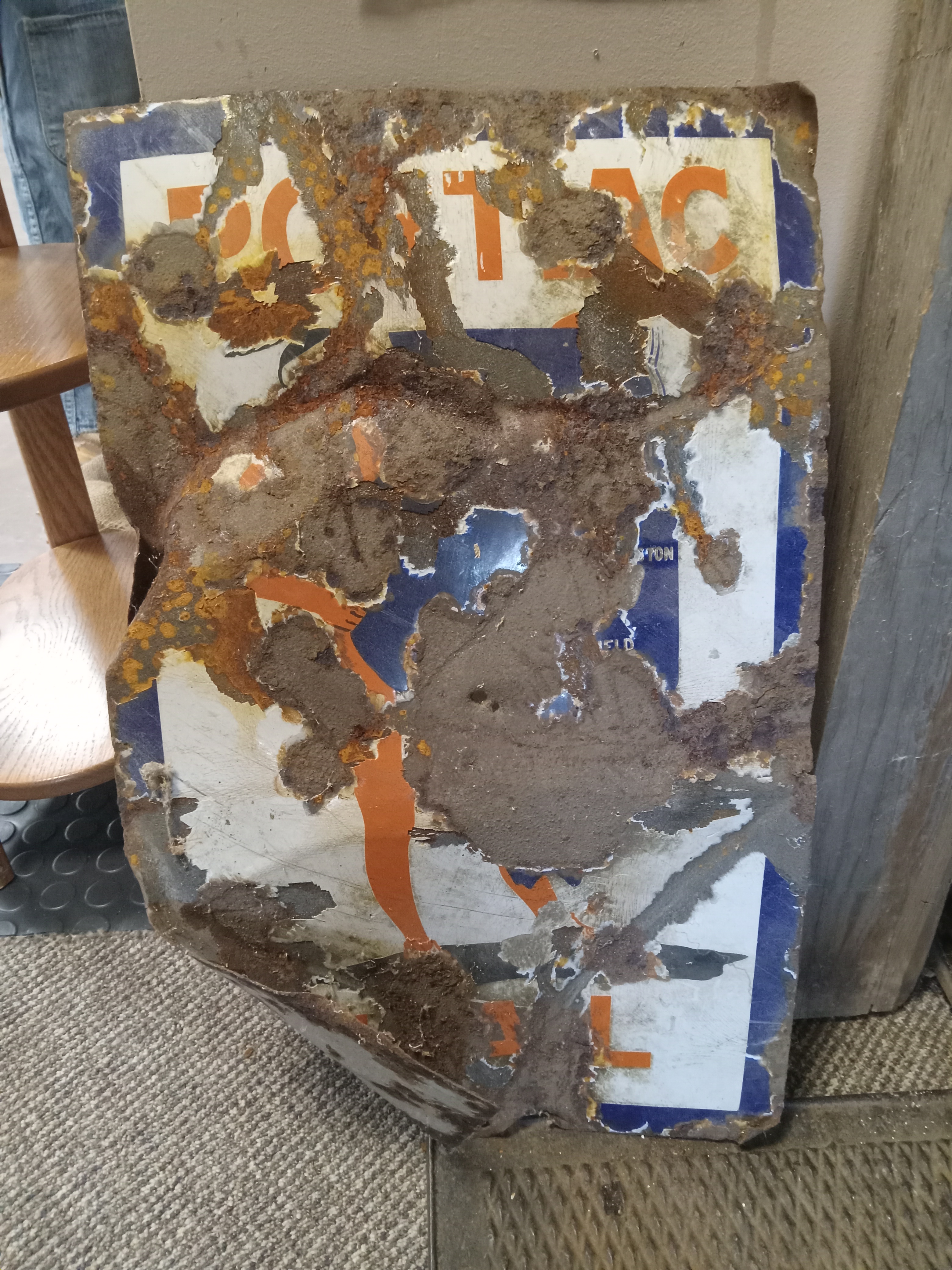
Continue to the end of Illinois Ave. and you’ll end at the Grundy County Historical Society, which has a museum. I visited here briefly to find out more information on the Pontiac Trail going through town. There are a couple of things: an old sign is there, damaged but legible, two old mileage signs whose writing looks like they were made from hammering small circles and painting them white (a lightbulb kind of look), and printed maps on where the trail went. I had the chance to talk with the society’s president, Kirk, about my trip and the intrigue on what would have happened if Route 66 had gone through Morris instead. Perhaps that old gas station on Southmor Road could have been a thing for much longer than what it was; and perhaps a Route 66 relic like Ambler’s Texaco.
Another interesting sight in Morris is about a block northwest of the historical society – the ruins of the former Gebhard Brewery at the end of Washington Street. Take a look at it, but don’t trespass. Then turn around and follow Washington Street straight across to the opposite end of town, and proceed out of town on Cemetery Road. We’re now heading toward Joliet and Minooka on the Pontiac Trail.
Evergreen Cemetery is at the edge of Morris. This is where Chief Shabbona is buried. (Click here for my post on Shabbona’s 250th birthday last year).
Going further east, the road winds parallel to the former Illinois and Michigan Canal, an early water route from Chicago to La Salle. A bike trail follows it going east from Morris. About 3.5 miles from Evergreen Cemetery is the crossing of Aux Sable Creek, and an aqueduct over it where the canal once went through. A lock keeper’s frame house also is at the sight, and it hosts the occasional history event. About 2 miles east of the Aux Sable, the road goes over the canal, and makes a left-handed curve – but turn right onto Hansel Road.
On Hansel Road, the Dollinger Family Farm is an all-ages agricultural destination. It is located in the former town of Dresden, and only the Dollinger buildings remain – one of which was the town’s former tavern. The Dresden name is perhaps more familiarly known as the name of the nuclear plant south and across the Illinois River. Go past the farm, and now we reach your typical suburbia scenery in Minooka. Hansen Road ends at Bell Road, and Bell Road meets U.S. 6, where you’ll turn right to go toward Channahon and Joliet. Subdivision planning isn’t kind of old, historic right-of-ways. The Hansen Road alignment is cut off, then remains, and cut off again in a general direction that follows U.S. 6 into Channahon.
From there, simply follow U.S. 6 into downtown Joliet, where you’ll reach the alignments of Route 66 again.
As cars became faster in the 1920s, and the desire to travel became greater, more efficient navigable roads needed to be part of the landscape. Small curves and 90-degree turnoffs were considered inconvenient to the desire of shorter time during travel. Going from Joliet to Morris to Dwight would have been slower than going from Joliet to Wilmington/Coal City to Dwight. South of Dwight, the Pontiac Trail didn’t always go on a diagonal path like Route 66 did. There were several “stair step” jogs on country roads along the way. Route 66 eliminated those “stairsteps” and made a much straighter path.
Morris was, and still is, larger than Coal City and Wilmington; and if that fact had convinced the 66 powers who were to have it go through Morris, perhaps we’d see the iconic Route 66 Gemini Giant in Morris instead of Wilmington? Maybe Donahue would still have his gas station? Maybe Mazon would have grown further west than what it looks like now? These are the quirky things I think about when I’m on my travels. Do you?
Joliet to Chicago
I have yet to travel on the Pontiac Trail alignment from Joliet to Chicago, but it, too, is not where Route 66 would eventually land. This path followed Illinois Route 171 largely from Joliet to Summit, and then Archer Ave. into Chicago’s Chinatown neighborhood.
“Largely” in this instance applies to the New Ave./Main St. stretch through Lemont and oil refineries, and stubs around where Route 171 crosses the Cal Sag Canal (a former bridge near the St. James Catholic Church in Lemont).
When Route 66 was established, the way out of Chicago instead went on Ogden Ave. and curving around McCook, Willowbrook and Romeoville to Joliet. As mentioned, the Pontiac Trail was also called Illinois Route 4. When Route 66 went onto the Ogden alignment, the Archer alignment was designated as Illinois Route 4A. The unusual 4A route ceased in 1967.
This trip was part of a two-day road trip that I took to Streator and Pontiac – and eventually to Morris. I have visited a couple of places in Pontiac, but I plan to return in May to see more and write a Pontiac-based post then.
